Suppose that someone had lived in Tucson for a couple of decades, then fell into a Rip van Winkle sleep for another couple of decades, and finally awoke last week. Rip van Winkle would be bewildered to hear that the monsoon starts Wednesday
, and that, alas, despite the approaching start date there's no rain in site
(as if rain in site would be normal for this date in June). As terrible as the wildfires have been this year, and as good as it would be to get enough rain to relieve the situation, that's not a realistic hope this early. The monsoon itself of course has not changed. There is still much year-to-year and week-to-week variability. The variability would make it difficult to detect long-term changes in the monsoon anyway. But there have been other changes over the past few decades.
One of those changes is that meteorologists across the country recognize the notion of a monsoon in this part of the country. That recognition is thanks to various publications that have established the use of the terms Southwest Monsoon or North American Monsoon to describe the circulation and rainfall changes in the broader region around Arizona. But those broader changes have always been recognized from Arizona. Even before there was an Arizona there were Tucsonans who enjoyed sitting on their patios, peering far into the southern horizon (almost as far as a radar beam can reach), watching thunderstorm anvils and distant lightning, and wondering when the rains would get to Tucson.
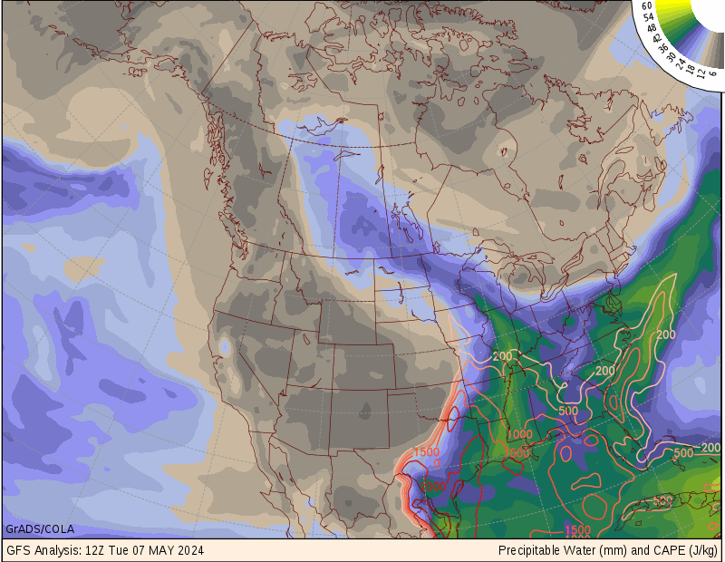
Another change over the past few decades is the development of a wider variety of remote sensing techniques for better discerning the distribution of moisture in the atmosphere. The old satellite standby, an image of water vapor, happens to focus on moisture in the middle layers of the atmosphere. It has been joined by extra satellite sensors and by other indirect techniques. All of the remote techniques have their uncertainties. Instead of trying to weigh the uncertainties myself, I rely on depictions of precipitable water (PW) as assimilated into numerical models. Specifically, I like the presentations at COLA's wxmaps.org. Their plots clearly identify key contour levels of PW. When those contours are viewed alongside the old-standby satellite water vapor image, you get some feeling for the vertical distribution of the moisture: whether it is confined mostly to the lower layers of the atmosphere, as is often the case at the very beginning of the monsoon, or whether thunderstorms on previous days have left considerable remnant moisture in the middle layers. If the moisture is mostly confined to the lower layers of the atmosphere, then 25 mm (1 inch) of PW corresponds to a daytime surface dewpoint in the mid-50's. The bottom line is that 25-30 mm of PW is the transition to the monsoon.
Although they are still far from perfect, the model assimilations and forecasts of PW are more reliable than they were a few decades ago, providing a picture of the advance of the monsoon well before it reaches the southern horizon. But once it reaches the International Border, I revert to remotely sensing out on the patio and enjoying the show.
No comments:
Post a Comment